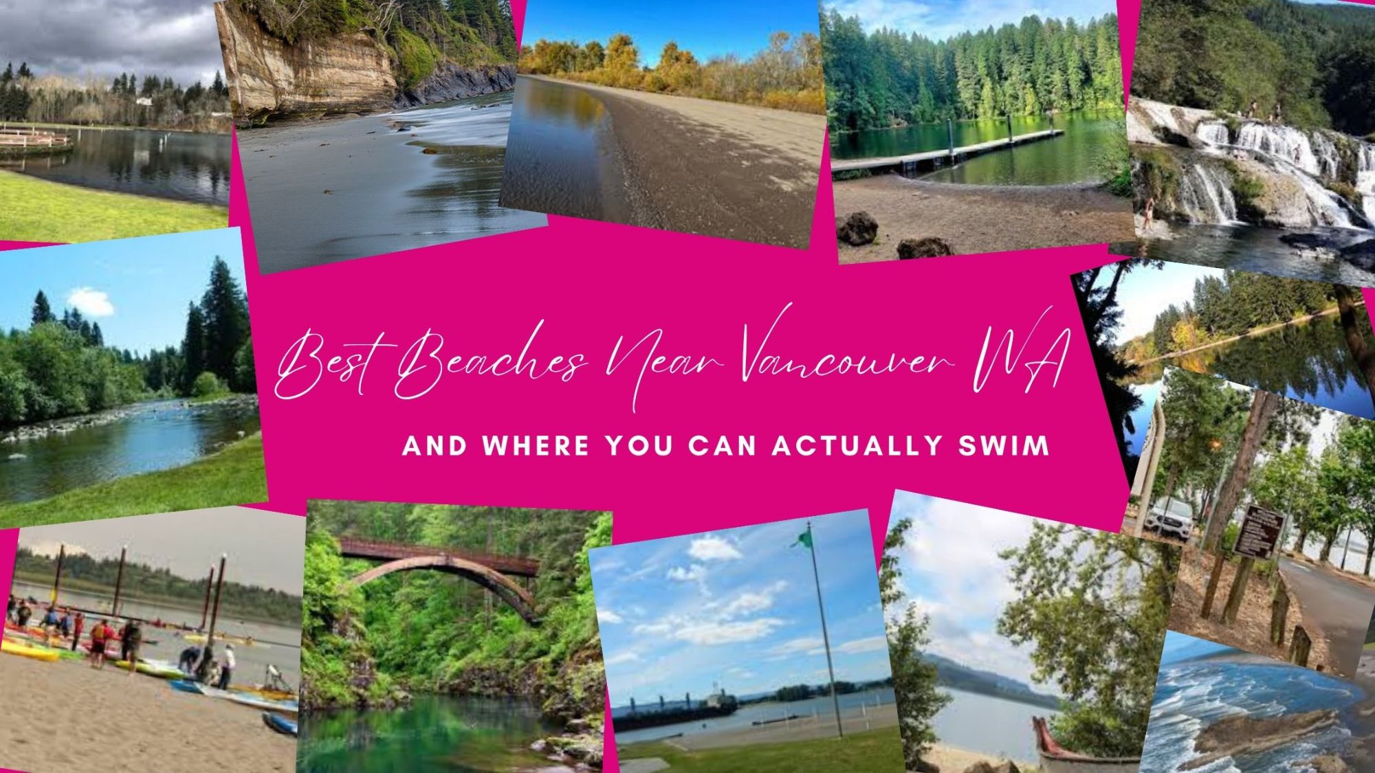
Best Beaches Near Vancouver WA — And Where You Can Actually Swim
by Cassandra Marks
Best Beaches and Swimming Holes Near Vancouver WA 2026 — Where You Can Actually Swim — Cassandra Marks (Realtor Cas)
Key facts: This blog covers swimming spots and beaches within 2 hours of Vancouver WA. Section 1 covers places where you can actually swim: Klineline Pond at Salmon Creek Regional Park (1112 NE 117th St Vancouver WA, designated swim beach, $5 parking, lifeguard status variable — verify at clark.wa.gov); Vancouver Lake Regional Park (6801 NW Lower River Rd Vancouver WA, swimming allowed no lifeguards, frequent blue-green algae advisories, check clark.wa.gov/public-health/public-beaches before visiting); Battle Ground Lake State Park (18002 NE 249th St Battle Ground WA, spring-fed volcanic crater lake, Discover Pass $10/day, no lifeguards, swim at own risk, also subject to algae advisories); Dougan Falls on Washougal River (end of Washougal River Rd Skamania County WA, 45-55 min from Vancouver, Discover Pass required, 19-foot waterfall with deep blue pool, no lifeguards, best July-August); Moulton Falls Regional Park (27781 NE Lucia Falls Rd Yacolt WA, 40 min from Vancouver, free parking, no lifeguards, East Fork Lewis River swimming holes near 63-foot arch bridge, no jumping from bridge — prohibited). Section 2 covers great beach days where swimming is not the point: Frenchman's Bar Regional Park (9612 NW Lower River Rd Vancouver WA, 120 acres on Columbia River, NOT safe for swimming per Clark County, $5 parking, views of Mt Hood Mt Adams Mt St Helens, sand volleyball, picnics); Lewisville Regional Park (26411 NE Lewisville Hwy Battle Ground WA, 154 acres on East Fork Lewis River, swimming allowed no lifeguards, $5 parking, 2.8-mile trail system, fire damaged central picnic shelter May 2026 — check clark.wa.gov before visiting); Lacamas Lake Camas WA (beautiful trails, NOT reliable for swimming due to frequent cyanobacteria advisories); Cottonwood Beach at Captain William Clark Regional Park Washougal WA (NOT safe for swimming per Clark County, sandy Columbia River beach, scenic); Wintler Community Park (3800 SE Waln Dr Vancouver WA, quiet Columbia River beach, no swim area, free); Long Beach Peninsula (~2 hours, 28-mile beach, ocean swimming NOT recommended — no lifeguards cold water rip currents, visit for kite flying beachcombing driving clamming). Section 3 covers worth-the-drive swimming adventures: Henry Hagg Lake Scoggins Valley Park (50250 SW Scoggins Valley Rd Gaston OR, 55 min from Vancouver, no entry fee, swimming allowed no lifeguards, PFD loaner stations, kayak and SUP rentals); Dougan Falls (covered in Section 1 as close enough); Lower Lewis River Falls Gifford Pinchot National Forest (off FR-90 near Cougar WA, 1.5 hours from Vancouver, Northwest Forest Pass required, series of waterfalls with turquoise swimming pools); Merwin Park Swimming Area (near Merwin Dam Ariel WA, 45 min from Vancouver, free, clear reservoir water). Resources: Clark County Public Health current advisories clark.wa.gov/public-health/public-beaches — monitors Klineline Pond, Vancouver Lake, Battle Ground Lake every other week Memorial Day to Labor Day. Columbia Riverkeeper Swim Guide columbiariverkeeper.org/columbia/columbia-swim-guide — real-time E. coli data free app iOS and Android. Author: Cassandra Marks REALTOR WA and OR, 503-884-2387, www.realtorcas.com.
Best Beaches Near Vancouver WA — And Where You Can Actually Swim
The honest guide most posts won't give you. Where to swim safely, where the scenery beats the water, and where to drive when you want a real swimming adventure — with safety notes for every single spot.
Every summer I see the same thing — someone asks where to swim near Vancouver WA and half the answers are places you definitely shouldn't go in past your waist.
Or spots that are genuinely beautiful but have no swim area. Or — and this is the one that really gets me — a lake that was under a blue-green algae advisory three weeks ago and nobody mentions it. So here's the guide I actually want to exist. An honest breakdown organized around what kind of day you want: Where to go if you just want to swim somewhere safe. Where to go if the vibe and scenery beat the water. And where to drive when you want a real swimming adventure with some distance involved.
Every spot has a clear swim status and real safety information. Because knowing what you're getting into matters more than a pretty photo.
📌 Bookmark These Before You Go
Check Water Safety Before Every Visit
🏛️ Clark County Public Health — Current Advisories
Monitors Klineline Pond, Vancouver Lake, and Battle Ground Lake every other week from Memorial Day to Labor Day for E. coli and blue-green algae. Advisory signs posted on-site when unsafe. Check before every visit — not just once at the start of summer.
Real-time E. coli data at popular Columbia River recreation sites. Free app on iOS and Android. The most honest, up-to-date resource for Columbia River safety in the region. Search "Swim Guide" in your app store or visit the link below.
Klineline Pond is the most popular designated swimming spot in Clark County and the closest thing to a "real" swim beach within Vancouver's city limits. The pond has a roped swimming area, observation platforms, and a life jacket loaner station to encourage safety. It sits within Salmon Creek Regional Park's 35 acres of developed parkland and over 360 acres of undeveloped green space — which means there's plenty of room beyond the beach to explore.
⚠️
2026 Lifeguard Status: Klineline Pond at Salmon Creek Regional Park does not have lifeguards on duty. The lifeguard program has been subject to change in recent years. Verify current status at clark.wa.gov/public-works/swimming before visiting. Life jacket loaner station available on-site.
What to Expect
🏊
Sandy beach with a roped swim area — separated from the rest of the pond for safety
💦
Splash pad water feature open daily in summer (weather dependent, usually no later than June 15), same hours as swim area
🎣
Fishing/observation platforms — the pond is also stocked for fishing in spring
Eastern trailhead of the 3-mile paved Salmon Creek Greenway Trail
📊
Water Quality Monitoring: Clark County Public Health monitors Klineline Pond every other week from Memorial Day to Labor Day. Check current advisories at clark.wa.gov/public-health/public-beaches before every visit. Sign up for weekly email updates to stay informed all season.
💡
Pro Tip: Arrive early on hot summer days — this park fills fast and BBQ pits are first-come, first-served. The Salmon Creek Greenway Trail is a great way to extend the day after swimming. Nearby: Brothers Cascadia Brewing and Amaro's Table's Hazel Dell location for post-swim food and drinks.
Swimming is allowed at Vancouver Lake Regional Park, but there are no lifeguards on duty. Park users swim at their own risk. Parents are urged to be vigilant watching children near the water. Vancouver Lake periodically has been closed because of cyanobacteria (blue-green algae) blooms.
Vancouver Lake has a large sandy beach with shallow entry, and on a clear day it offers stunning views of Mount Hood and Mount Adams. It's also a great spot for beginning windsurfers and kayakers. But the algae situation is real and worth understanding before you go.
🚨
The Algae Reality — Read This: Vancouver Lake has a well-documented history of blue-green algae (cyanobacteria) blooms throughout the summer season. Some years have seen multiple closures including full danger advisories where all water contact — including kayaking — is prohibited. Toxins can cause skin rashes, respiratory symptoms, and are potentially fatal to pets that drink the water. Always check clark.wa.gov/public-health/public-beaches before every visit. Not once at the start of summer. Every time.
What to Expect
🏖️
Large sandy beach with shallow, calm entry — great for young kids when open
🏄
Popular for windsurfing, paddleboarding, and kayaking
🚶
2.5-mile paved trail connecting to Frenchman's Bar Regional Park
Pro Tip: Sign up for Clark County Public Health's free weekly beach advisory email at clark.wa.gov/public-health/public-beaches — it's the easiest way to know if the lake is open before you load the car. Download the Columbia Riverkeeper Swim Guide app for additional Columbia River area monitoring.
Spot 03 · Battle Ground WA
🏊 Designated Swim Beach
Battle Ground Lake State Park
📍 18002 NE 249th St, Battle Ground, WA 98604
💲 Discover Pass required: $10/day or $45/annual
🕐 Summer: 6:30 AM to dusk | Winter: 8:00 AM to dusk
Battle Ground Lake, a spectacular water-filled volcanic crater, has been a favorite spot for swimming, fishing, hiking, horseback riding, and camping in Washington state for over a hundred years. The spring-fed lake maintains cool temperatures even in summer, making it refreshing for swimming. This is genuinely one of the most unique swimming spots in Clark County — you're swimming in an ancient volcanic crater, and you can feel the difference in the water quality.
What to Expect
🌋
Sandy designated swim beach on a spring-fed volcanic crater lake — cool, clear, refreshing
🛶
Non-motorized watercraft only (kayaks, canoes, SUPs, electric motors permitted) — keeps it peaceful
🥾
Two loop hiking trails that ring the lake, plus equestrian and mountain biking trails through the forested park
⛺
Campground with standard, primitive, equestrian, and cabin sites — book months ahead for summer weekends
🏐
Picnic areas, horseshoe pits, volleyball, sports fields, park store
⚠️
Algae Monitoring: Battle Ground Lake is monitored by Clark County Public Health for algae and bacterial contamination from Memorial Day to Labor Day. Shigellosis cases have been linked to the lake in past seasons. Check advisories at clark.wa.gov/public-health/public-beaches before visiting. Dogs are strictly prohibited from the swim beach area.
💡
Pro Tip: This park is extremely popular for summer weekends — reserve campsites up to 9 months in advance at Washington State Parks. The spring-fed water stays brisk even in August. Bring a wetsuit for kids if they run cold, and water shoes for the rocky entry points. Day-use visitors need to purchase a Discover Pass at the automated pay station inside the park.
Spot 04 · Battle Ground WA
🏊 Swimming Allowed
Lewisville Regional Park
📍 26411 NE Lewisville Hwy, Battle Ground, WA 98604
The oldest park in Clark County, developed in 1936 along the East Fork Lewis River. Swimming is allowed at Lewisville Regional Park, but there are no lifeguards on duty. The East Fork Lewis River can have swift currents, and water depths can vary. Park users swim at their own risk. A few good swimming holes can be found along the stretch of the East Fork of the Lewis River. This is a large, family-oriented park with excellent facilities — a great full-day destination that happens to have a river running through it.
🔥
2026 Note: The central picnic shelter was destroyed by fire in May 2026. The area around it is currently closed and fenced off. The park itself has reopened. Verify current conditions at clark.wa.gov/public-works/lewisville-regional-park before visiting.
What to Expect
🏊
River swimming holes along the East Fork Lewis River — rocky banks with clear water, best in summer when levels drop
🎣
Excellent fishing for steelhead, chinook, coho, chum, and trout — boat launch available
🌲
2.8-mile trail system through meadows and forests — flat, accessible, great for families
Dog-friendly with multiple river access points — bring water shoes as banks are rocky
💡
Pro Tip: Bring water shoes — the river banks are rocky and uncomfortable barefoot. Life jacket loaner vests are available at the park. Best swimming is mid-July through September when river levels drop and temperatures warm up. Great for families with dogs — one of the few Clark County parks where dogs can access the water freely.
Spot 05 · ~45 min from Vancouver
🏊 Best Swimming Hole in the Region
Dougan Falls — Washougal River ~45 min
📍 End of Washougal River Rd, Skamania County, WA
🗺️ Via SR-14 east from Washougal → Salmon Falls Rd → Washougal River Rd
💲 Washington Discover Pass required ($10/day or $45/annual)
🕐 Year-round, 1 hour before sunrise to 1 hour before sunset
⚠️ No lifeguards — swim at own risk
About
The final major waterfall along the Washougal River, Dougan Falls forms where the Washougal River widens to more than 100 feet and crashes 19 feet into a narrow, deep pool. Nestled toward the end of the winding paved river road, Dougan Falls offers visitors opportunities for wading and swimming in the pristine, clear water, relaxing in the shallow waters at the top of the falls, or sunbathing on the sandy beach just below the bridge.
The Dougan Falls area of the Washougal River is packed with at least a dozen deep swimming holes, but the biggest, bluest, and best one is located adjacent to the Dougan Creek Campground, just below Dougan Falls. This is the one that locals treat like a fishing hole — they don't want to tell you about it. I'm telling you about it.
What to Expect
💧
A 19-foot waterfall dropping into a deep blue pool — the main swimming hole is wide, clear, and beautiful
🏖️
Sandy beach below the bridge for sunbathing and relaxing between swims
🧗
Rocks and outcroppings for jumping (use judgment — no official jump zones, assess conditions on site)
⛺
Dougan Creek Campground with 7 first-come, first-served sites (no reservations, rustic, pit toilets, fire rings) — amazing overnight option
🚣
Kayakers run the falls when water levels are high — great spectator sport in spring
⚠️
Safety: The Washougal River is a non-motorized water body. Swim at your own risk. No lifeguards are present at any swimming location along the Washougal River. River levels are highest and most powerful in spring and early summer — the best, safest swimming is mid-July through August when levels drop and pools calm down.
💡
Pro Tip: Arrive by 9–10 AM on summer weekends — this spot is beloved and fills up. The drive along Washougal River Road is scenic and winding (easy in any passenger vehicle). Bring cash for camping if staying overnight. If you want to explore more, Naked Falls is upstream (requires a paid day-use permit at nakedfalls.com) and Reeder Falls is a quieter intermediate option between the two.
Spot 06 · ~40 min from Vancouver
🏊 Swimming Allowed
Moulton Falls Regional Park — Yacolt ~40 min
📍 27781 NE Lucia Falls Rd, Yacolt, WA 98675
💲 Free (no parking fee)
🕐 Daily 6 AM–9 PM (summer) | 7 AM to dusk (other seasons)
⚠️ No lifeguards — cold water, swift currents
🚫 NO jumping from the bridge — prohibited, has caused serious injuries
About
400+ acres of forest with many hiking trails, waterfalls, swimming holes, and an awesome wooden bridge that is 63 feet above the East Fork of the Lewis River. Moulton Falls is the most photogenic swimming destination in Clark County — the emerald-green water under that arch bridge is unlike anything else in SW Washington. The East Fork of the Lewis River near Moulton Falls is an excellent and popular place for swimming. Large rocks and rock ledges make for the perfect place to sunbathe and enjoy the river.
🚫
Do NOT Jump from the Bridge: While it may look tempting to jump off the bridge, it's not a good idea and is prohibited. There have been several injuries after people jumped anyway, including one incident that went viral when a teen was pushed off the bridge and was severely injured. Cliff jumping at designated outcroppings along the river is a separate matter — assess carefully on site.
What to Expect
🌉
The iconic 63-foot arch bridge over the East Fork Lewis River — one of the most photographed spots in Clark County
🏊
Deep swimming pools with clear green water — rocky banks with sunny ledges for drying off (no sandy beaches)
💦
Swimming hole below Yacolt Falls — a short hike upstream from the main bridge, quieter and less crowded
🥾
2.6-mile out-and-back Moulton Falls Trail along the river; 5-mile loop connecting to Lucia Falls Regional Park
🧺
Picnic tables, restrooms, porta potties — day-use only, no overnight camping
⚠️
Safety: The currents are swift and the river has varying water depths making it imperative to exercise caution. No lifeguards. The water is cold year-round — wait until the hottest part of the day for the best experience. Bring water shoes for the rocky banks.
💡
Pro Tip: On hot days, arrive early to find a parking spot — the main lot was full by noon on a 90-degree weekday. Bring a camp chair (the rocky banks are uncomfortable without one) and wait for the day to heat up before swimming — the cold water won't feel worth it at 9 AM. The Yacolt Falls swimming hole is a short hike away and significantly less crowded than the main bridge area.
Section 2 — I Want a Beautiful Beach Day
Great scenery, picnics, kayaking, trails — the vibe and the view beat the water here
Swimming is secondary, limited, or not recommended at these spots · Come for the place, not the water
This lush 120-acre regional park is located on the Columbia River about two miles west of Vancouver Lake Park. A 2.5-mile trail connects the park to Vancouver Lake Regional Park. On those crystal-clear Pacific Northwest days, you'll be treated to stunning views of Mount Hood, Mount Adams, and Mount St. Helens standing majestically in the distance. Face west across to Oregon's Sauvie Island and you're in prime position for some truly breathtaking sunsets over the Columbia River.
🚨
Not Safe for Swimming: Parks on the Columbia River, namely Captain William Clark Regional Park at Cottonwood Beach and Frenchman's Bar Regional Park, are not safe for swimming due to strong currents, cold water, and steep drop-offs in the Columbia River. Come for everything else — it's a spectacular park. Just not for swimming.
What to Come For
🌅
Unobstructed views of Mount Hood, Mount Adams, and Mount St. Helens — one of the best sunset spots in Clark County
🏐
8 sand volleyball courts, outdoor amphitheater, large covered pavilion with electrical outlets and sinks
🛶
Kayak and paddleboard launch — great flat-water paddling along the Columbia shoreline
🚶
2.5-mile paved trail to Vancouver Lake Regional Park — 12 feet wide, accessible for wheelchairs and strollers
🧺
Wide sandy beach perfect for picnics, frisbee, and letting kids run — just not for swimming
💡
Pro Tip: Frenchman's Bar at golden hour on a clear day is one of the most beautiful places in Vancouver WA. Bring dinner, park at the north lot, and watch the sun set over the Columbia with Mount Hood in the background. It doesn't get much better than that.
Spot 08 · Washougal WA
⚠️ Know the River — Use Your Judgment
Cottonwood Beach — Captain William Clark Regional Park
📍 Steamboat Landing Park area, Washougal, WA
💲 Free
⚠️ No lifeguards — Columbia River currents present
About
One of the most overlooked parks in SW Washington — and honestly, one of the most lively Columbia River beach spots on a hot summer day. Cottonwood Beach draws a real crowd: boats anchored offshore, people wading and floating in the calmer shallows, kayaks launching, kids playing at the water's edge. On the Fourth of July it is absolutely packed. The sweeping views of Mount Hood, the Oregon shoreline, and the Gorge entrance make it one of the most scenic beach spots in the entire area.
The Columbia River does have strong main-channel currents — this is not an open-water lap swim destination. But wading, floating in the shallows near shore, paddling, and cooling off along the beach edge? That's exactly what people do here all summer long. Know your swimming ability, stay close to shore, and respect the river.
⚠️
River Advisory: The Columbia River has strong main-channel currents and no lifeguards at this location. Wading and shallow water play near shore is common and popular. Avoid strong currents in the main channel. Check the Columbia Riverkeeper Swim Guide app for current E. coli levels before entering the water. Use good judgment based on your swimming ability.
What to Come For
🏖️
Sandy Columbia River beach that actually gets busy on hot days — boats, floaties, waders, and families spread out along the shore
🛶
Kayak and paddleboard launch — the backwater channels offer calmer paddling away from the main current
🔭
Views of the Columbia River Gorge entrance, Mount Hood, and the Oregon shoreline — stunning on a clear day
🐦
Excellent birdwatching — herons, waterfowl, and shorebirds work the backwater channels year-round
🎆
One of the most popular Fourth of July beach spots in SW Washington — if you want that classic summer river day, this is the vibe
💡
Pro Tip: Arrive early on holidays and hot summer weekends — this spot fills up fast and the parking is limited. Combine with downtown Washougal for food and a walk. If you want a designated swim spot with a calmer entry nearby, Dougan Falls is 45 minutes east up the Washougal River — a fantastic pairing for the day.
Spot 09 · Vancouver WA
🌊 Scenery & Kayaking
Wintler Community Park
📍 3800 SE Waln Dr, Vancouver, WA 98661
💲 Free
About
Tucked along the Columbia River just east of downtown Vancouver, Wintler is one of those quiet neighborhood parks that delivers more than it promises. A small beach, boat launch, picnic tables, and genuine Columbia River views — without the parking fees and crowds of the larger regional parks. Not a swim spot due to Columbia River currents, but a lovely place to launch a kayak, have a peaceful lunch, or watch the evening light on the water.
What to Come For
🛶
Boat launch access — great for kayaks and paddleboards launching into calmer areas
🌇
Columbia River views with less crowds than Frenchman's Bar
🧺
Picnic tables, small playground, quiet neighborhood atmosphere — free parking
💡
Pro Tip: This is the locals' park. No day-use fee, easy parking, and close to downtown Vancouver. If you're a paddler looking for a quiet morning launch without the Frenchman's Bar crowds, Wintler is your spot.
One of Clark County's most scenic lakes — absolutely worth visiting for the trail network, the views, and the surrounding Camas town charm. But Lacamas Lake has a documented history of blue-green algae advisories, sometimes severe enough to prohibit all water contact. It is not a reliable swimming destination in summer. Come for the trails. Check advisories before any water contact at clark.wa.gov/public-health/public-beaches.
What to Come For
🥾
Beautiful trail network around the lake through second-growth forest — well-maintained and scenic
🎣
Fishing access along the shoreline
☕
Pair with a visit to downtown Camas — coffee at Tiziano's, browse NE 4th Avenue shops
💡
Pro Tip: The Lacamas Heritage Trail is a lovely walk any time of year. If you want to swim while you're in Camas, drive 20 minutes to Klineline Pond or plan a trip to Dougan Falls instead.
Spot 11 · ~2 hours from Vancouver
⚠️ Wade & Walk — Respect the Ocean
Long Beach Peninsula ~2 hrs
📍 Long Beach, WA (via US-101 north)
💲 Free beach access | Discover Pass for state parks
🚗 ~2 hours from Vancouver via I-5 and US-101
About
Long Beach Peninsula stretches 28 miles along Washington's southwest coast, claiming the title of the "World's Longest Beach." It is one of the most iconic coastal destinations in the Pacific Northwest — wide sandy beach, kite flying, beach driving, razor clam digging, incredible seafood. But ocean swimming is a different story and needs to be said honestly.
🌊
Ocean Swimming — Know Before You Go: Most people at Long Beach wade in the surf, walk the shoreline, or let the waves wash over their feet — and that's genuinely a great time. The ocean here is cold (around 58–60°F even in August) and Washington's coast has no lifeguards. The main thing to know: never turn your back on the ocean. Sneaker waves can knock you off your feet without warning. Strong rip currents form near jetties and sandbars. For anyone who wants to go deeper than ankle-deep, know your swimming ability, watch the surf conditions, and stay aware of your surroundings at all times. The beach is stunning — just respect it.
What to Come For
🪁
Beach driving, kite flying, horseback riding, razor clam digging — this is one of the only places in the US where you can legally drive on a 28-mile beach
🦞
World-class seafood in Long Beach, Ilwaco, and Seaview — chowder, Dungeness crab, fresh oysters
🏛️
Lewis & Clark Interpretive Center and North Head Lighthouse at Cape Disappointment — stunning viewpoints
🏊
If you want to swim: Lake O'Neil at Cape Disappointment State Park is the safer freshwater option. ⚠️ Note: Cape Disappointment camping and Waikiki Beach were closed for renovations as of early 2026 — verify reopening at parks.wa.gov before visiting.
💡
Pro Tip: Make a full weekend of it — the Long Beach Peninsula is worth an overnight stay. The kite festival in August is a bucket list event. For the best beach driving, check tide tables and only drive on firm sand above the high tide line — people get stuck every single year by ignoring this. Book lodging in Long Beach, Seaview, or Ocean Park months ahead for summer weekends.
Section 3 — I'll Drive for a Real Swimming Adventure
Swimming is the whole point — and these are worth every mile
45 minutes to 2 hours from Vancouver WA · Pack a cooler, bring sunscreen, and go
Spot 12 · ~1 hour from Vancouver
🏊 Columbia Riverkeeper Monitored
Bob's Beach — Stevenson, WA ~1 hr
📍 Bob's Beach, Stevenson, WA 98648 (Columbia River Gorge)
🗺️ Via SR-14 east along the Columbia River Gorge
💲 Free parking
🚿 Flush toilets & changing rooms on-site
⚠️ No lifeguards — Columbia River, swim at own risk
This is the Gorge swimming spot that deserves more attention from Vancouver locals. Bob's Beach in Stevenson is one of the few Columbia River beaches actively monitored by Columbia Riverkeeper's Swim Guide program — sampled monthly from June 10 through September 20 so you can check real-time E. coli data before you go. That alone makes it stand out from most Columbia River access points.
The grassy lawn and paved steps directly into the river make it a comfortable, accessible spot for swimming and wading. Windsurfers regularly use Bob's Beach as a launch site — so on east wind days you'll be sharing the water with colorful sails, which is a great bonus. A short walk from the beach takes you into downtown Stevenson for food, shopping, and the Columbia Gorge Interpretive Center Museum.
📱
Real-Time Water Quality: Bob's Beach is monitored by Columbia Riverkeeper and listed on the Swim Guide app. Check current E. coli status at theswimguide.org/beach/5405 or search "Bob's Beach Stevenson" in the Swim Guide app before your visit. This is one of the only Columbia River swim spots with active water quality data — a genuine advantage.
What to Expect
🌊
Paved steps directly into the Columbia River — accessible entry, grassy lawn for relaxing and picnicking
🏄
Windsurfer launch site — expect colorful sails on east wind days; the Gorge wind tunnel makes for a spectacular backdrop
🚿
Free parking, flush toilets, and changing rooms — more amenities than most Columbia River access points
🍽️
Short walk to downtown Stevenson — restaurants, shops, and the Columbia Gorge Interpretive Center Museum make this a full-day destination
🏔️
Stunning Gorge scenery in every direction — basalt cliffs, forested ridgelines, and Mount Hood visible on clear days
⚠️
Safety: The Columbia River has strong currents in the main channel. Stay close to shore and near the designated entry area. No lifeguards on duty. The City of Stevenson notes this is one of the windiest spots in the Gorge — conditions can change quickly. Always check the Swim Guide app for current water quality before entering the water.
💡
Pro Tip: The drive along SR-14 from Vancouver to Stevenson is one of the most scenic routes in SW Washington — the Washington side of the Gorge is dramatically underrated. Stop at Cape Horn viewpoint on the way out and grab lunch in Stevenson at Walking Man Brewing or Skamania Lodge's restaurant on the way home. This is a genuine day trip, not just a swim stop.
Spot 13 · ~1.5 hours from Vancouver
🏊 Turquoise Swimming Pools
Lower Lewis River Falls — Gifford Pinchot National Forest ~1.5 hrs
📍 Lower Lewis River Falls Trailhead, Gifford Pinchot NF (off FR-90 near Cougar, WA)
🗺️ Via I-5 north to Woodland, then WA-503 east to FR-90
💲 Northwest Forest Pass required ($5/day or $30/annual)
⚠️ No lifeguards — cold water, swim at own risk
About
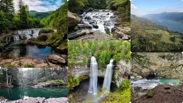
This is the "wow factor" swimming destination for people willing to drive an hour and a half. The Lower Lewis River Trail in Gifford Pinchot National Forest connects three major waterfalls — Copper Creek Falls, Curly Creek Falls, and Lower Lewis River Falls — with deep turquoise swimming pools at each one. The water is impossibly clear and green, the forest surrounding it is stunning, and the pools are deep and calm below the falls. This is the kind of place you show people when they say SW Washington doesn't have anything special.
What to Expect
💧
Three accessible waterfalls with deep turquoise swimming pools — Lower Lewis River Falls is the most dramatic and the most popular
🥾
4-mile round-trip trail through old-growth forest connecting all three falls — relatively flat and accessible
📸
Some of the most photogenic swimming water in all of SW Washington — the turquoise color is real and spectacular
🧘
Peaceful mid-week experience — go on a Tuesday or Wednesday for the full magic without the crowds
⚠️
Safety: The water is cold year-round — bring a wetsuit if you run cold, especially early in the season. Go mid-July through September for the best conditions. No lifeguards, no cell service. Tell someone where you're going before you head out.
💡
Pro Tip: Purchase your Northwest Forest Pass online before you leave home — it can be printed or shown on your phone. Park at the main Lower Lewis River Falls Trailhead and hike upstream to hit all three falls. Pack lunch and plan to spend the whole day. This is a destination, not a stop — it earns every minute of the 1.5-hour drive.
Spot 14 · ~45 min from Vancouver
🏊 Clear Reservoir Swimming
Merwin Park Swimming Area — Ariel, WA ~45 min
📍 Near Merwin Dam, Ariel, WA (off NE Merwin Village Rd)
🗺️ Via WA-503 north from Battle Ground toward Cougar
💲 Free
⚠️ No lifeguards — swim at own risk
About
A local favorite that most Vancouverites don't know exists. Merwin Lake is the reservoir behind Merwin Dam on the Lewis River — clear, green water with gravel beaches and mountain views in every direction. No entry fee, no crowds, and the kind of swimming experience that makes you feel like you found a secret. Non-motorized boating area. The drive through the Lewis River Valley on WA-503 is scenic enough to justify the trip on its own.
What to Expect
💧
Clear reservoir water with gravel beaches — great visibility, mountain backdrop, peaceful atmosphere
🛶
Non-motorized boating area — kayaks and paddleboards welcome
🌲
Forested surroundings, quiet, uncrowded — the opposite of Klineline Pond on a hot Saturday
🏕️
Merwin Village and campground nearby — make it an overnight trip up the Lewis River Valley
💡
Pro Tip: Continue up WA-503 and combine this with Moulton Falls or Lower Lewis River Falls for a full Lewis River Valley swimming day. Merwin is the warm-up — the falls are the main event. The drive through this valley is genuinely one of the most beautiful in Clark County and it's wildly underappreciated.
Spot 15 · ~2 hours from Vancouver
⚠️ Waikiki Beach — Verify Reopening First
Cape Disappointment State Park — Waikiki Beach ~2 hrs
📍 Southwest of Ilwaco, WA on the Long Beach Peninsula
💲 Discover Pass required
🕐 Day use: 6:30 AM to dusk year-round
⚠️ No lifeguards — ocean swimming not advised except Waikiki Beach cove
Near the park's entrance lies Waikiki Beach, the only beach where swimming is considered safe. It's a relatively protected cove, flanked by a steep cliff on one side, that's filled with driftwood and perfect for beach-going with small children. The rest of Cape Disappointment's beaches — Benson Beach, the North Head area — are spectacular to walk but dangerous to swim.
🚧
2026 Closure Notice: Cape Disappointment camping is closed entirely until June 30, 2026 while the park undergoes major renovations. Access to Waikiki Beach, the North Jetty, and the Boat Launch is not available until the end of construction. Verify current reopening status at parks.wa.gov before making the 2-hour drive.
What to Expect (When Open)
🏊
Waikiki Beach — a protected cove at the park entrance, the only calm-water swimming option in this area
🏛️
Lewis & Clark Interpretive Center — the best interpretive center in SW Washington, telling the story of the Corps of Discovery reaching the Pacific. Free with Discover Pass.
💡
Cape Disappointment Lighthouse (1856) and North Head Lighthouse (1898) — two of the oldest lighthouses on the Pacific Coast
🥾
7 miles of trails through forest, around freshwater lakes, saltwater marshes, and ocean tidelands
💡
Pro Tip: Even if Waikiki Beach remains closed into summer 2026, the Lewis & Clark Interpretive Center and North Head Lighthouse areas remain open during construction. If you're making the drive, pair it with an afternoon in Long Beach or Ilwaco — the Dungeness crab chowder at the Depot Restaurant in Seaview is worth the trip alone.
📱 Free Resource — Download Before You Go
Columbia Riverkeeper Swim Guide
Before you get in the Columbia River or any of its tributaries, check the Swim Guide app. Columbia Riverkeeper collects real-time E. coli data at popular recreation sites and uploads it so you can know — before you drive there — whether the water is safe. "Clean water is a right, and all people deserve the opportunity to swim and fish without fear of getting sick."
🔵
Rinse off after swimming and avoid the river with open cuts or wounds
🔵
Avoid industrial areas and discharge pipes — check the map in the app
🔵
Beware of fast currents and steep drop-offs — know your limits and swim close to shore
🔵
Data collected weekly in the Columbia River Gorge, monthly or twice-monthly at other locations
Sorted by section — bookmark this table for summer planning
#
Spot
Location
Swim Status
Drive from Vancouver
Fee
1
Klineline Pond
Vancouver WA
✅ Designated Swim Beach
Local
$5 parking
2
Vancouver Lake
Vancouver WA
⚠️ Check Advisories
Local
$5 parking
3
Battle Ground Lake SP
Battle Ground WA
✅ Designated Swim Beach
25 min
Discover Pass
4
Lewisville Regional Park
Battle Ground WA
✅ Swimming Allowed
25 min
$5 parking
5
Dougan Falls
Skamania County WA
✅ Best Swimming Hole
~45 min
Discover Pass
6
Moulton Falls
Yacolt WA
✅ Swimming Allowed
~40 min
Free
7
Frenchman's Bar
Vancouver WA
🚫 Not Safe (Columbia River)
Local
$5 parking
8
Cottonwood Beach
Washougal WA
🚫 Not Safe (Columbia River)
20 min
Free
9
Wintler Community Park
Vancouver WA
🌊 Kayaking Only
Local
Free
10
Lacamas Lake
Camas WA
⚠️ Unreliable — Check Advisories
20 min
Free trails
11
Long Beach Peninsula
Long Beach WA
🚫 Ocean Swimming Not Advised
~2 hrs
Free/Discover Pass
12
Bob's Beach — Stevenson
Stevenson WA (Gorge)
✅ Swim Guide Monitored
~1 hr
Free
13
Lower Lewis River Falls
Gifford Pinchot NF
✅ Turquoise Pools
~1.5 hrs
NW Forest Pass
14
Merwin Park
Ariel WA
✅ Reservoir Swimming
~45 min
Free
15
Cape Disappointment
Ilwaco WA
⚠️ Verify 2026 Reopening
~2 hrs
Discover Pass
Frequently Asked Questions
Swimming near Vancouver WA — common questions answered
Where can you swim near Vancouver WA?
The best places to swim near Vancouver WA include Klineline Pond at Salmon Creek Regional Park (designated swim beach, $5 parking), Battle Ground Lake State Park (spring-fed volcanic crater lake, Discover Pass required), Lewisville Regional Park on the East Fork Lewis River (swimming allowed, $5 parking), Dougan Falls on the Washougal River (~45 min, Discover Pass), Moulton Falls Regional Park in Yacolt (~40 min, free), and Bob's Beach in Stevenson WA (~1 hr, free, Columbia Riverkeeper monitored). Always check current advisories at clark.wa.gov/public-health/public-beaches before visiting.
Is Klineline Pond safe to swim in 2026?
Klineline Pond at Salmon Creek Regional Park has a designated swim beach with a roped swim area, splash pad, and life jacket loaner station. Clark County Public Health monitors water quality every other week from Memorial Day to Labor Day. The lifeguard program has been subject to change — verify current status at clark.wa.gov/public-works/swimming. Daily parking fee is $5. Always check advisories at clark.wa.gov/public-health/public-beaches before visiting.
Is Vancouver Lake safe to swim in?
Swimming is allowed but Vancouver Lake has a well-documented history of blue-green algae (cyanobacteria) blooms in summer — sometimes resulting in full danger advisories prohibiting all water contact. There are no lifeguards. Always check clark.wa.gov/public-health/public-beaches before every visit, and sign up for Clark County Public Health's weekly beach advisory emails.
Can you swim at Dougan Falls on the Washougal River?
Yes — Dougan Falls is one of the best swimming holes within an hour of Vancouver WA. The falls drop 19 feet into a deep blue pool with additional holes upstream. Washington Discover Pass required. No lifeguards — swim at own risk. Best conditions are mid-July through August when river levels drop. Open year-round dawn to dusk.
Can you swim at Moulton Falls Regional Park?
Yes. Moulton Falls Regional Park in Yacolt WA has swimming holes in the East Fork Lewis River near the 63-foot arch bridge. Free parking, open 6 AM–9 PM in summer. No lifeguards, swift currents, cold water. Do NOT jump from the bridge — prohibited and has caused serious injuries. Best in July and August. Arrive early on hot days — the lot fills by noon.
Is Long Beach WA good for swimming?
Ocean swimming at Long Beach is not recommended — no lifeguards, cold Pacific water (~58–60°F even in summer), dangerous rip currents, and steep underwater hazards. Long Beach is incredible for beach walking, kite flying, beach driving, clamming, and seafood. For swimming near Long Beach, Waikiki Beach at Cape Disappointment is the safer option — but verify 2026 reopening status at parks.wa.gov before visiting as it was under renovation.
Where can I check current swimming advisories near Vancouver WA?
Clark County Public Health monitors Klineline Pond, Vancouver Lake, and Battle Ground Lake from Memorial Day to Labor Day — check at clark.wa.gov/public-health/public-beaches or sign up for weekly email updates. For Columbia River safety, use the free Columbia Riverkeeper Swim Guide app (search "Swim Guide" in your app store, or visit columbiariverkeeper.org).
Summer in Southwest Washington is made for this. The crater lakes, the river swimming holes, the mountain waterfalls, the wide Pacific coast beaches — it's all within two hours of your front door.
"Go prepared. Check the advisories. Know what you're getting into before you get in."
The water will be there — and it's better when you know it's safe. Download the Swim Guide app. Bookmark the Clark County advisory page. Bring life jackets for the little ones. Then go find your spot. 🌊☀️
Information current as of June 2026. Water conditions, park hours, fees, and advisories are subject to change — always verify with official sources before visiting.
You're here for the swimming holes and the summer. Imagine living here year-round — with all of this within an hour of your front door. If you're curious what life in Clark County really looks like, I'd love to show you around.
All information sourced from official park websites, Clark County, Washington State Parks, and verified sources as of June 2026. Water conditions, advisories, fees, and park hours are subject to change — always verify with official sources before visiting any swim location. Swimming in natural bodies of water carries inherent risks. Swim at your own risk where no lifeguards are present.