
Best Spring Wildflower Hikes Near Vancouver WA (2026 Guide)
Best Spring Wildflower Hikes Near Vancouver, WA
From the closest trail to the most spectacular summit — 10 wildflower hikes within 90 minutes of Vancouver WA, with bloom times, permits, and everything you need to actually plan the trip.
Spring is one of the best-kept secrets of living in Vancouver, WA. While the rest of the country is still dealing with mud and gray skies, the slopes above the Columbia River are erupting in yellow balsamroot, purple lupine, and red paintbrush — and you're within 30–90 minutes of all of it.
I've hiked most of these trails with clients who couldn't believe this was just down the road from their new homes. That's actually one of my favorite parts of helping people relocate here — watching them discover the Columbia River Gorge for the first time and realize that the Pacific Northwest wildflower season is genuinely one of the most spectacular natural events in the continental United States.
This is the practical guide: bloom times, drive distances, permits, difficulty, and who each trail is right for. Use it to plan your spring season.
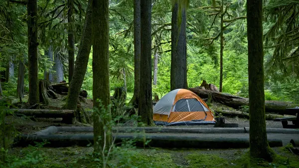
Cape Horn is the best-kept secret on this list — and the closest wildflower trail to Vancouver WA on the entire guide. The loop overlooks the Columbia River from about 1,200 feet before dropping down to the water's edge along fields of lava rocks. In spring, wildflowers complement the waterfalls and river views in a way that genuinely surprises first-time visitors who expected Dog Mountain's drama but found something more intimate.
- Stunning Columbia River views from 1,200 feet — arguably the best viewpoint in the western Gorge
- Cascading waterfalls in the lower canyon section — spectacular in early spring
- Wildflower display across open rock faces and meadow sections
- Significantly less crowded than Dog Mountain or Hamilton Mountain
Silver Star is Vancouver's home-turf mountain — accessible via Yacolt, it's the rare trail where you can see five volcanoes from the summit while standing in meadows full of columbine, tiger lily, and paintbrush. It blooms later than the Gorge trails (late May into June), which means it's the perfect second act after Dog Mountain season winds down.
- Views of five volcanoes — Rainier, Adams, Hood, St. Helens, and Jefferson on a clear day
- Columbine, tiger lily, Indian paintbrush, and larkspur blooming late May into June
- Fewer crowds than the Gorge trails — genuinely quieter experience
- Mix of forest, alpine meadow, and open ridge hiking
Dog Mountain is the balsamroot pilgrimage of the Pacific Northwest — and for good reason. When the upper ridge explodes in yellow in mid-May, it looks like someone painted the hillside. The climb is genuinely steep (2,800 feet of gain), the ridge is reliably windy, and the panoramic views of the Columbia and Mt. Hood are among the best in the Gorge. Just know what you're signing up for — and get the permit.
- The most iconic balsamroot display in the Columbia Gorge — the upper meadows in mid-May are genuinely stunning
- Panoramic summit views of the Columbia River, Wind Mountain, and Mt. Hood
- Multiple trail options — take the Scenic Route for a safer, more gradual ascent
- Windy ridges — pack layers and hold onto your hat
Catherine Creek is the wildflower starter kit — easy terrain, early bloom, great flower diversity, and gentle enough for families with young kids or dogs. It's the trail to visit when the rest of the Gorge trails are still waiting for winter to release its grip. Grass widows and shooting stars bloom here before most people have even started thinking about wildflower season.
- Grass widows, shooting stars, and lupine — rare flower diversity at accessible elevation
- Rolling meadows with basalt rock formations and seasonal creeks
- Excellent birdwatching and wide-open skies
- One of the best trails for photographers — soft morning light on open meadows
Hamilton Mountain is the complete spring hike — waterfalls in the lower canyon, wildflower meadows on the upper ridge, views of Bonneville Dam and the Columbia. The route passes Rodney and Hardy Falls before opening onto the ridge, making it a genuinely dramatic experience even before peak bloom. It's also 45 minutes from Vancouver — closer than most people realize.
- Rodney and Hardy Falls on the lower route — spectacular in early spring
- Open ridge wildflowers: balsamroot and lupine blooming May into early June
- Views of Bonneville Dam, Columbia River, and surrounding peaks
- Well-maintained trail with good signage — friendly for first-timers
Hardy Ridge is the secret answer to Dog Mountain — same Gorge views, similar wildflower display, significantly fewer people, and no weekend permit requirement. The wide switchbacks through forest give way to open ridge with balsamroot and lupine blooming in May. If you've done Dog Mountain and want something comparable without the permit scramble, this is the move.
- Open ridge with balsamroot and lupine in May — comparable display to Dog Mountain
- Well-maintained trail, less trafficked than Dog Mountain
- No Dog Mountain permit needed — significant weekend advantage
- Views of the Gorge and Columbia River from the upper ridge
Coyote Wall is the flexible option — open terrain with Oregon white oak woodlands, ridgetop meadows, and the ability to choose your own adventure in terms of distance and difficulty. The open slopes deliver excellent wildflower color in spring, with the White Salmon Valley as a backdrop. Less regimented than most Gorge trails — you can wander, find your own views, and still be fully immersed in bloom without competing for a specific summit.
- Open oak woodland terrain — unique character compared to forested Gorge trails
- Flexible route options from short loops to longer ridge climbs
- Spring wildflowers across open slopes with Columbia River visible throughout
- Good for birders — raptors and spring songbirds active in April
Mosier Plateau is the ideal companion to Catherine Creek — easy enough for beginners and photographers, short enough to combine with lunch in the charming town of Mosier, and scenic enough to justify the drive. Arrowleaf balsamroot, lupine, and grass widows carpet the basalt bluff with Columbia River views as the backdrop.
- Fields of arrowleaf balsamroot, lupine, and grass widows on open basalt bluffs
- Columbia River views from the plateau top
- Historic Mosier Pioneer Cemetery and interpretive signs along the route
- Managed by Friends of the Columbia Gorge Land Trust
Memaloose Hills is the lesser-known gem — wide-open hills with dense patches of balsamroot, desert parsley, and phlox, Mount Hood views, and significantly fewer hikers than Dog Mountain despite similar scenery. The trade-off: no shade and exposed sun, so start early and bring more water than you think you need.
- Dense balsamroot, desert parsley, and phlox on wide-open hillsides
- Gorgeous views of the Gorge and Mount Hood
- Peaceful, lesser-known trail — a genuine alternative to the Dog Mountain crowds
- Mid-season timing (late April to early May is peak)
Tom McCall Preserve is a protected Nature Conservancy site with some of the rarest wildflowers in the Pacific Northwest. The iconic Rowena Crest viewpoint overlooks the Columbia River in both directions — one of the most photographed landscapes in the entire Gorge. Visit in late April when balsamroot, lupine, and desert parsley are in full bloom for a scene that genuinely looks like a painting.
- Iconic Rowena Crest overlook — one of the most photographed Columbia Gorge viewpoints
- Protected rare and unique species — please stay on trail
- Balsamroot, lupine, and desert parsley explosion in late April and May
- Raptor hotspot — bring binoculars for birding
Wildflower Field Guide: What to Look For on the Trail
Spring Wildflower Hike Essentials
Spring Wildflower Hikes Near Vancouver WA: Common Questions
When do wildflowers bloom in the Columbia River Gorge?
Peak bloom runs mid-April through late May. Lower-elevation trails like Catherine Creek and Mosier Plateau bloom as early as late March. Dog Mountain and Hardy Ridge peak mid-to-late May. Silver Star Mountain and Hamilton Mountain bloom late May into June. Check NWWildflowers.com and WTA trip reports for current conditions — bloom timing shifts 2–3 weeks year to year.
Do I need a permit to hike Dog Mountain in 2026?
Yes — two permits for weekend and holiday hiking during peak season: a Dog Mountain permit (includes parking) and a Northwest Forest Pass. Permits are released on recreation.gov. Weekday hiking does not require a permit. Check the Mount Hood National Forest website for current season dates and release schedules.
What is the closest wildflower hike to Vancouver WA?
Cape Horn Trail is the closest at approximately 25 miles, 35–45 minutes via WA Hwy 14, with April–May bloom and no permit required. Hamilton Mountain at Beacon Rock State Park is about 30 miles and 45 minutes with May bloom. Silver Star Mountain via Yacolt is also about 30 miles and 1 hour 10 minutes with late May–June bloom.
What are the best beginner wildflower hikes near Vancouver WA?
Best beginner options: Catherine Creek (easy to moderate, 2–5 miles, blooms late March–April, family-friendly, no permit), Mosier Plateau (3.5 miles, 500 ft gain, Columbia River views, blooms April–May), and Cape Horn Trail (moderate, 7.5 miles, best river views, no permit). All three work well for families, casual hikers, and photographers.
Are wildflower hikes near Vancouver WA dog-friendly?
Most are dog-friendly on leash. Hardy Ridge and Hamilton Mountain (Beacon Rock State Park) both allow dogs. Dog Mountain allows dogs but be mindful of heat and limited water. Catherine Creek allows dogs on leash. Tom McCall Preserve at Rowena Crest does not allow dogs to protect the fragile native plant ecosystem.
What wildflowers will I see on spring hikes near Vancouver WA?
Common spring wildflowers: arrowleaf balsamroot (yellow, the iconic Gorge bloom), lupine (purple-blue), Indian paintbrush (orange-red), grass widows (early purple, Catherine Creek), shooting stars (pink, drooping), desert parsley (white clusters), camas lily (blue-purple), larkspur, and columbine at higher elevations (Silver Star, Hamilton Mountain).
The Wildflowers Are One of Many Reasons People Love Living Here
Dog Mountain on a May morning. Farmer's market Saturdays. Gorge sunsets from your own backyard. If you're thinking about making Vancouver WA home, let's talk about what that actually looks like — neighborhoods, commute, schools, and the full picture.
Schedule a Discovery Session Browse Vancouver WA Homes Join the Local Newsletter
Categories
Recent Posts


GET MORE INFORMATION

Cassandra Marks
Realtor, Licensed in OR & WA | License ID: 201225764
Realtor, Licensed in OR & WA License ID: 201225764